
Thomas Rouse Trail
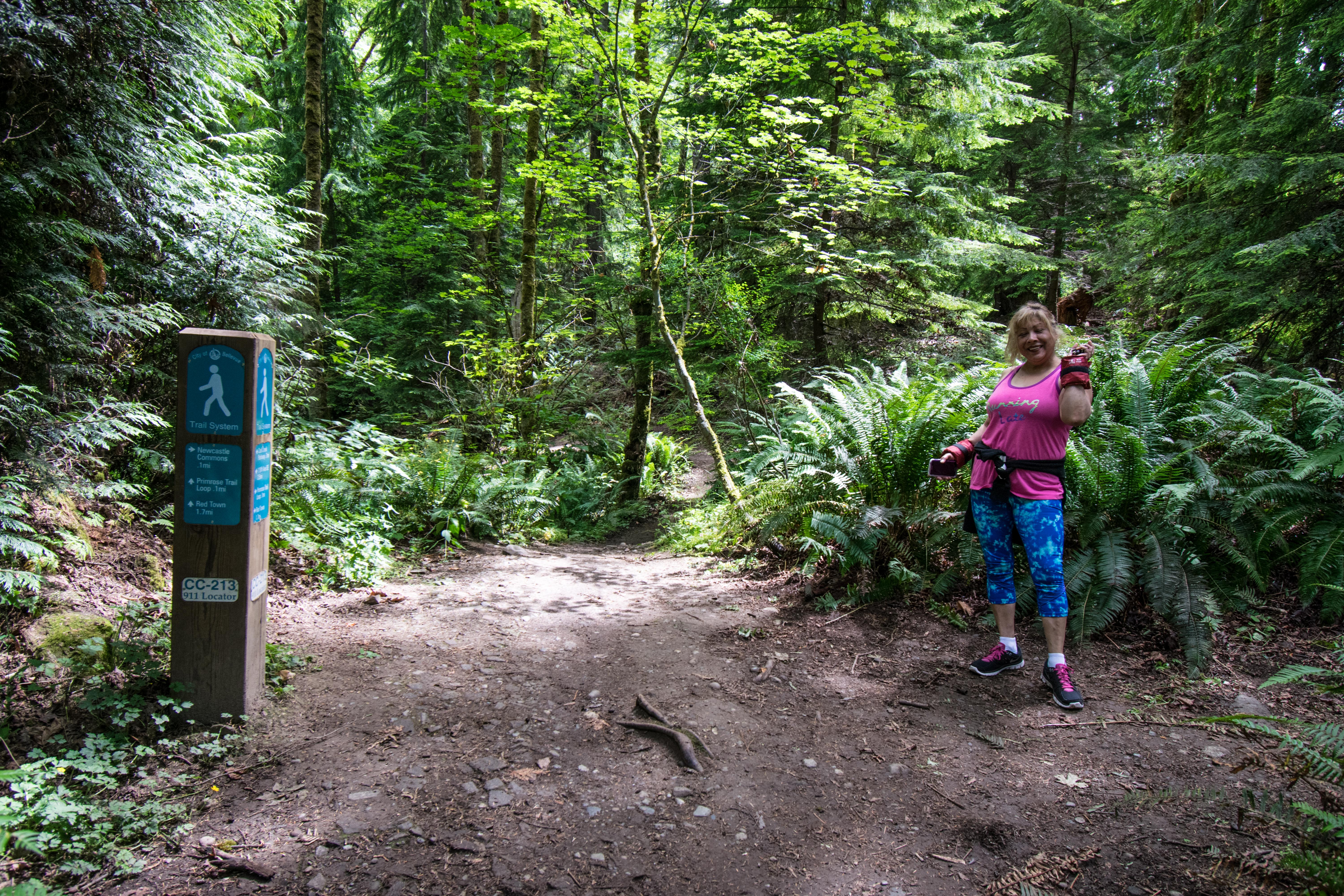
01 Trailhead on Coal Creek Trail near Newcastle Commons
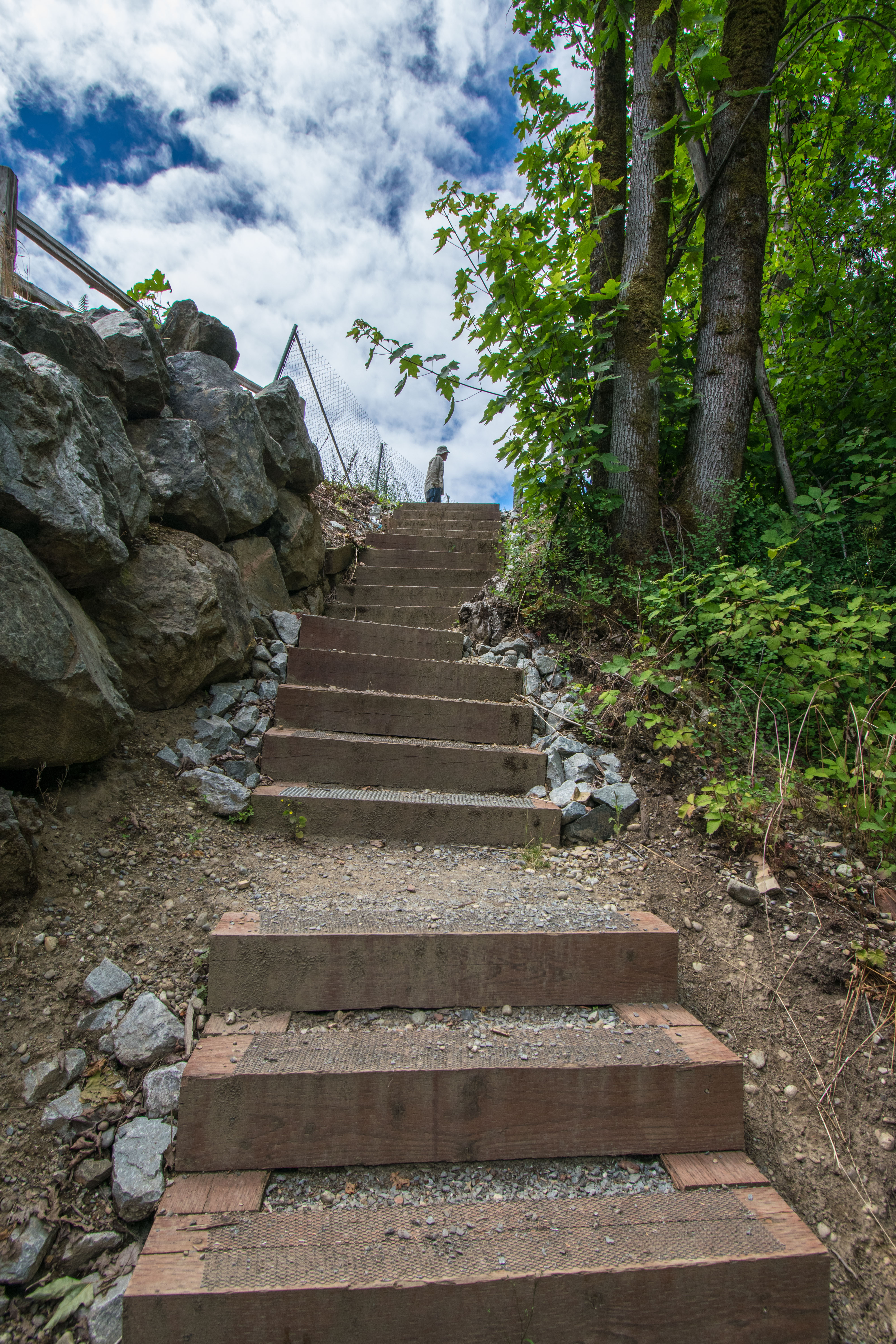
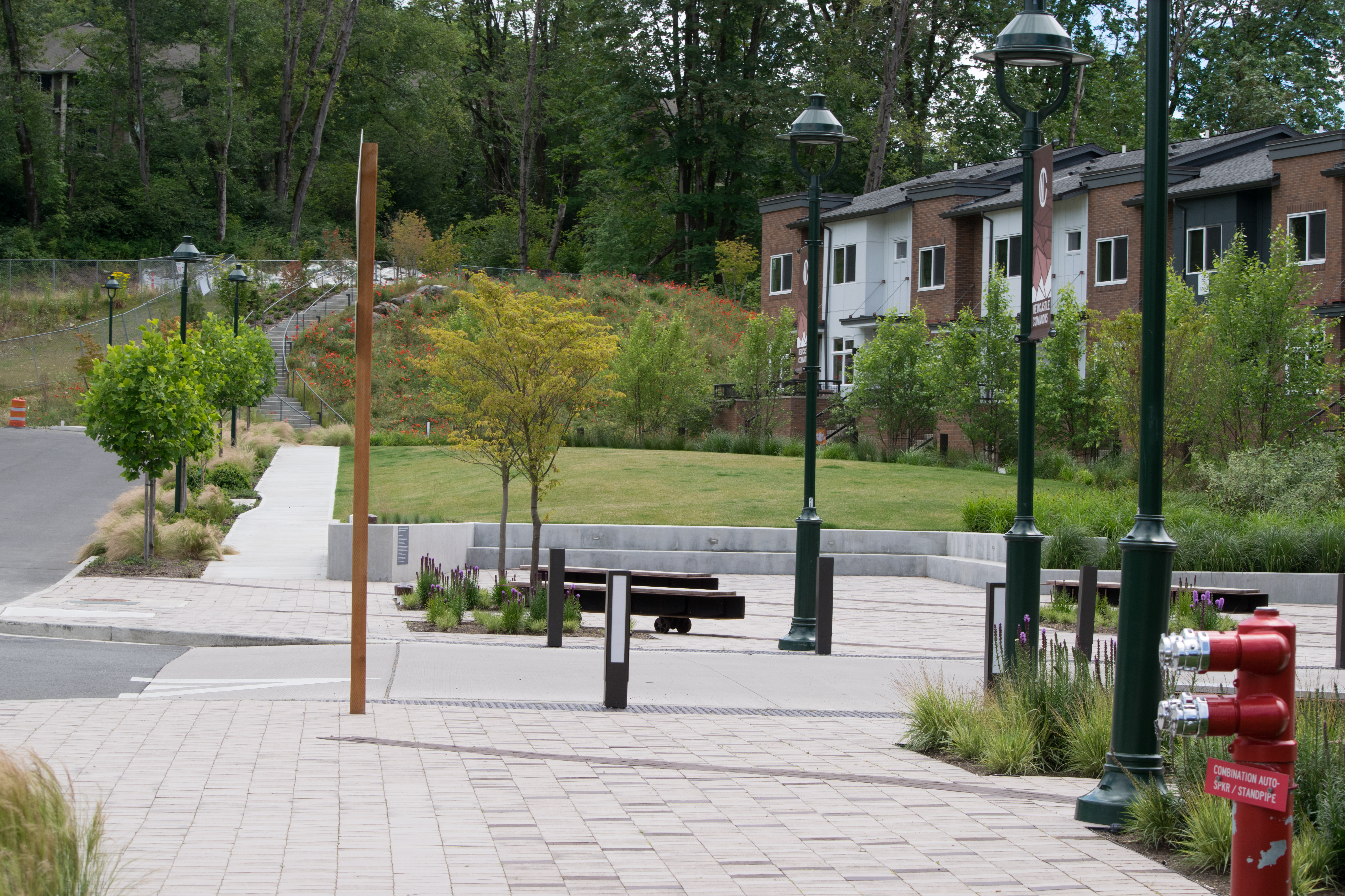
02 Steps up to Newcastle Commons
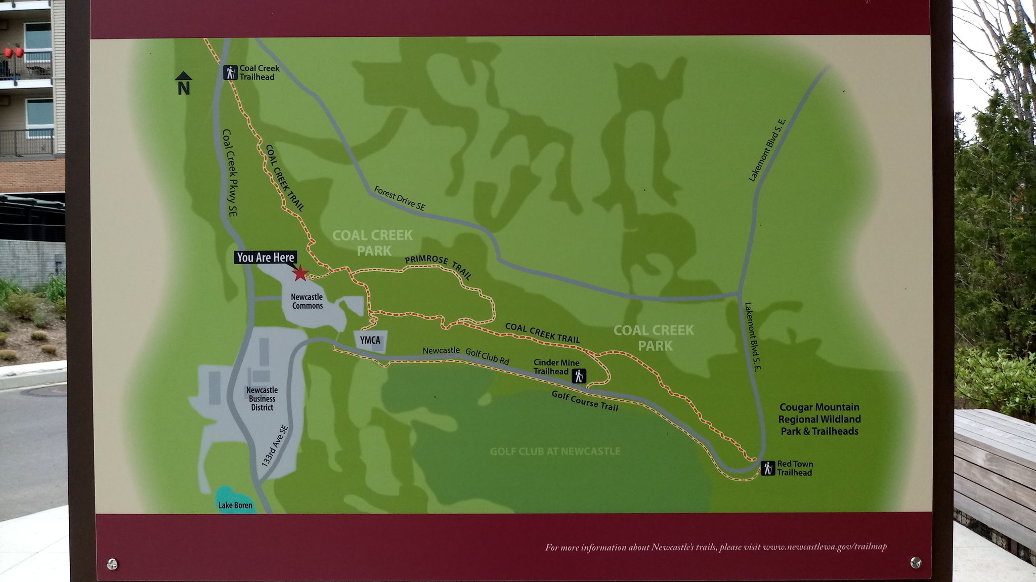
03 Map in Display Area at edge of Commons
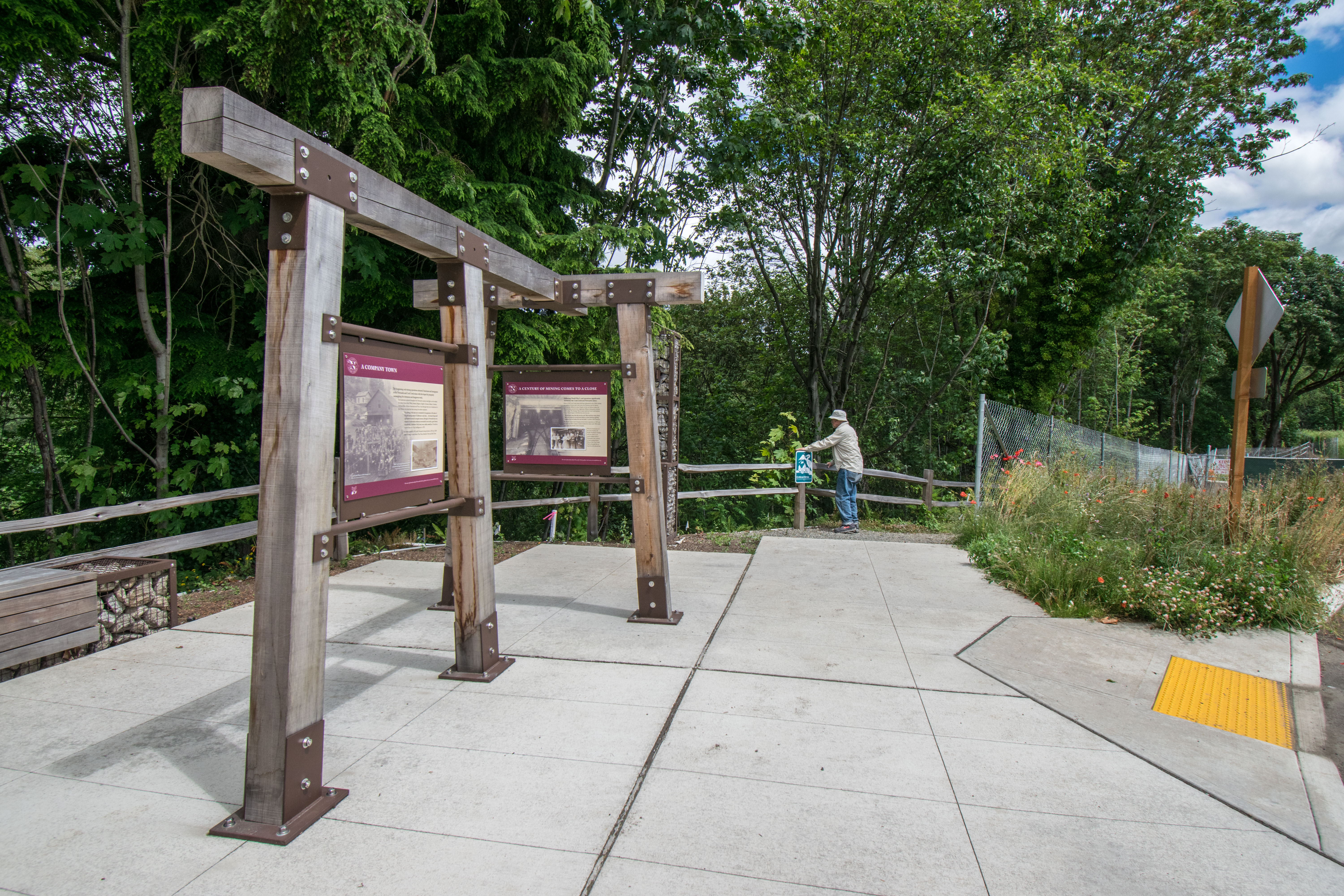
04 Looking Back from Display Area towards Coal Creek Trail
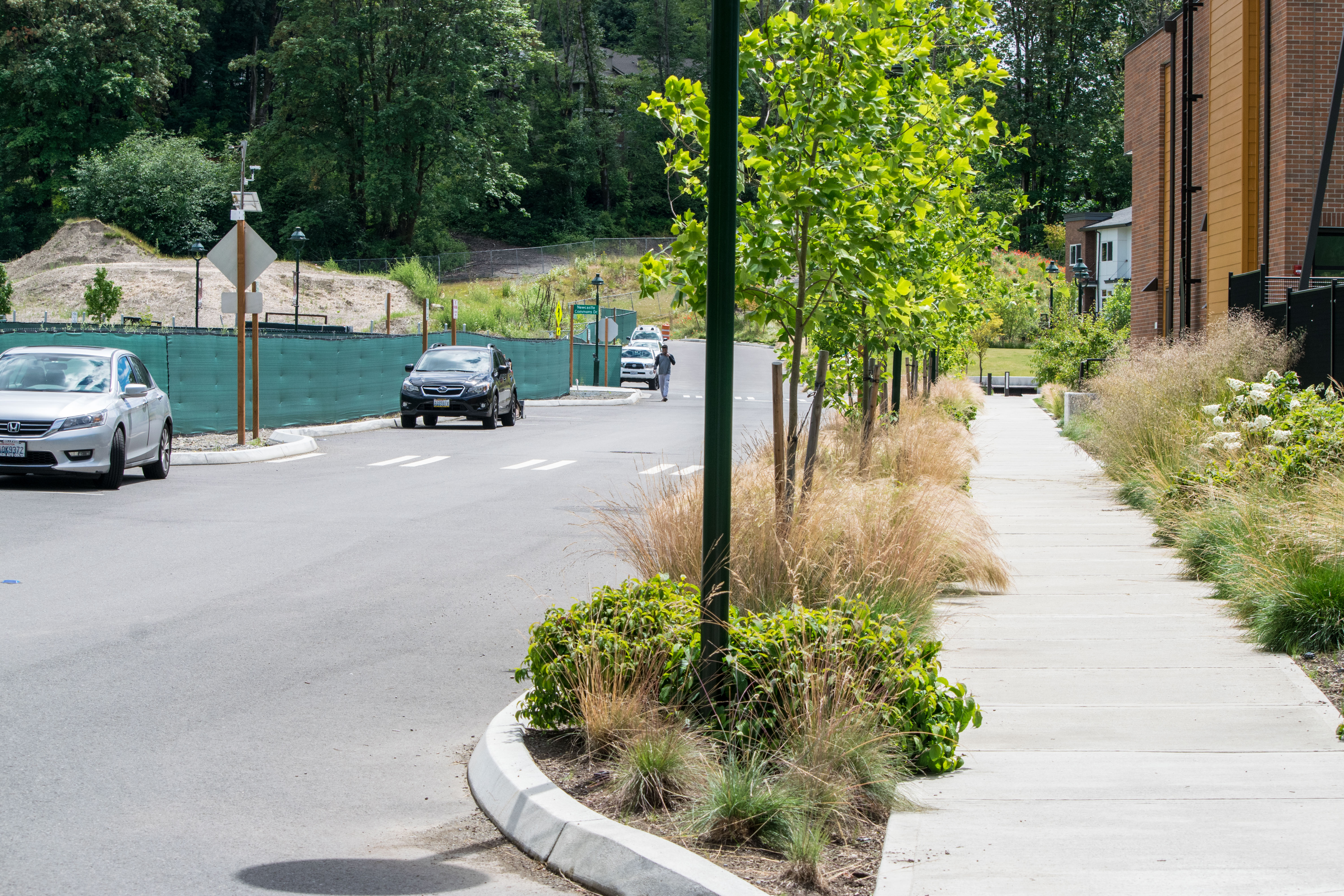
05 Trail Heading South on Sidewalk through Commons
06 Trail on Sidewalk crossing Newcastle Commons Drive
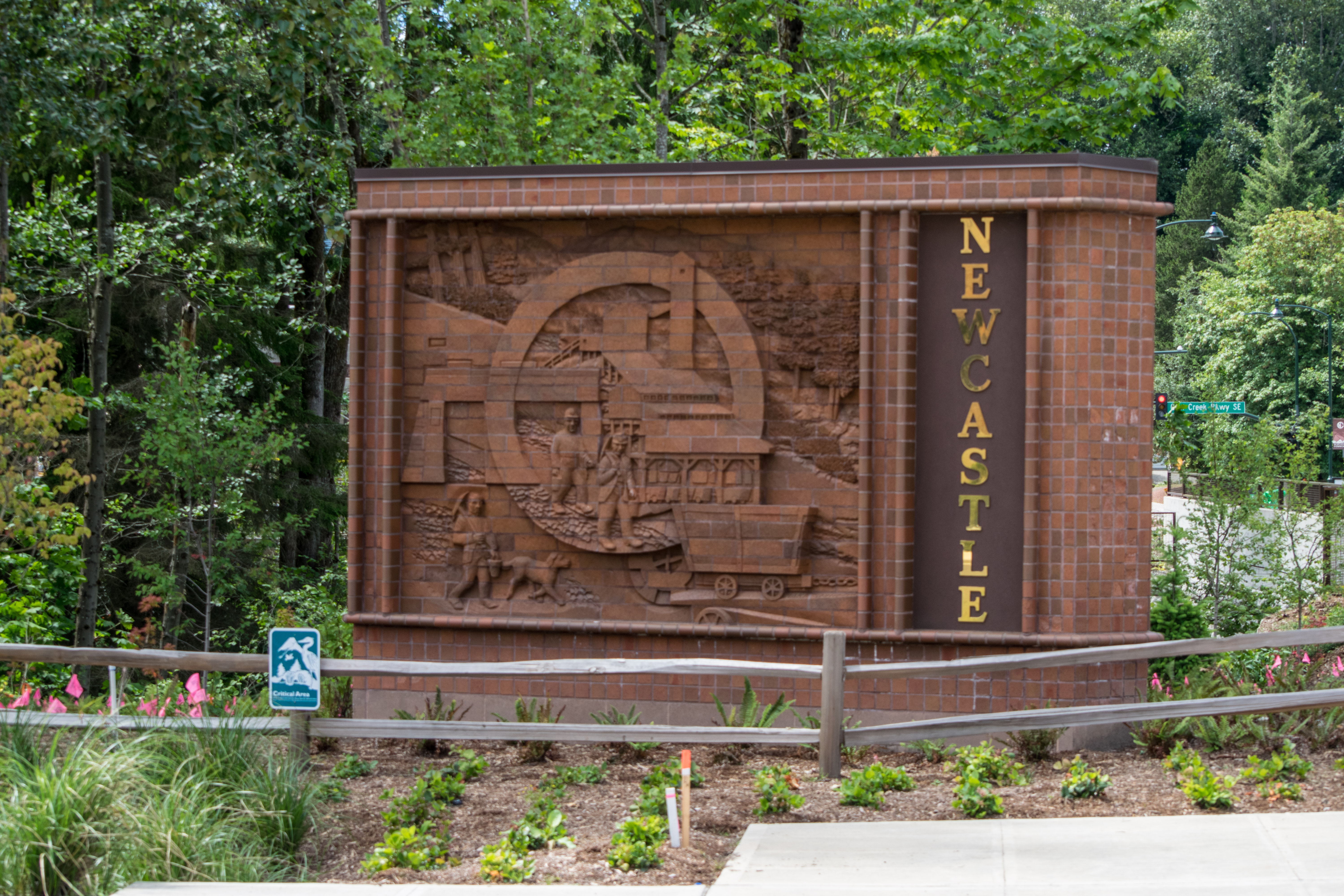
07 Newcastle Monument on Commons Drive West of Trail
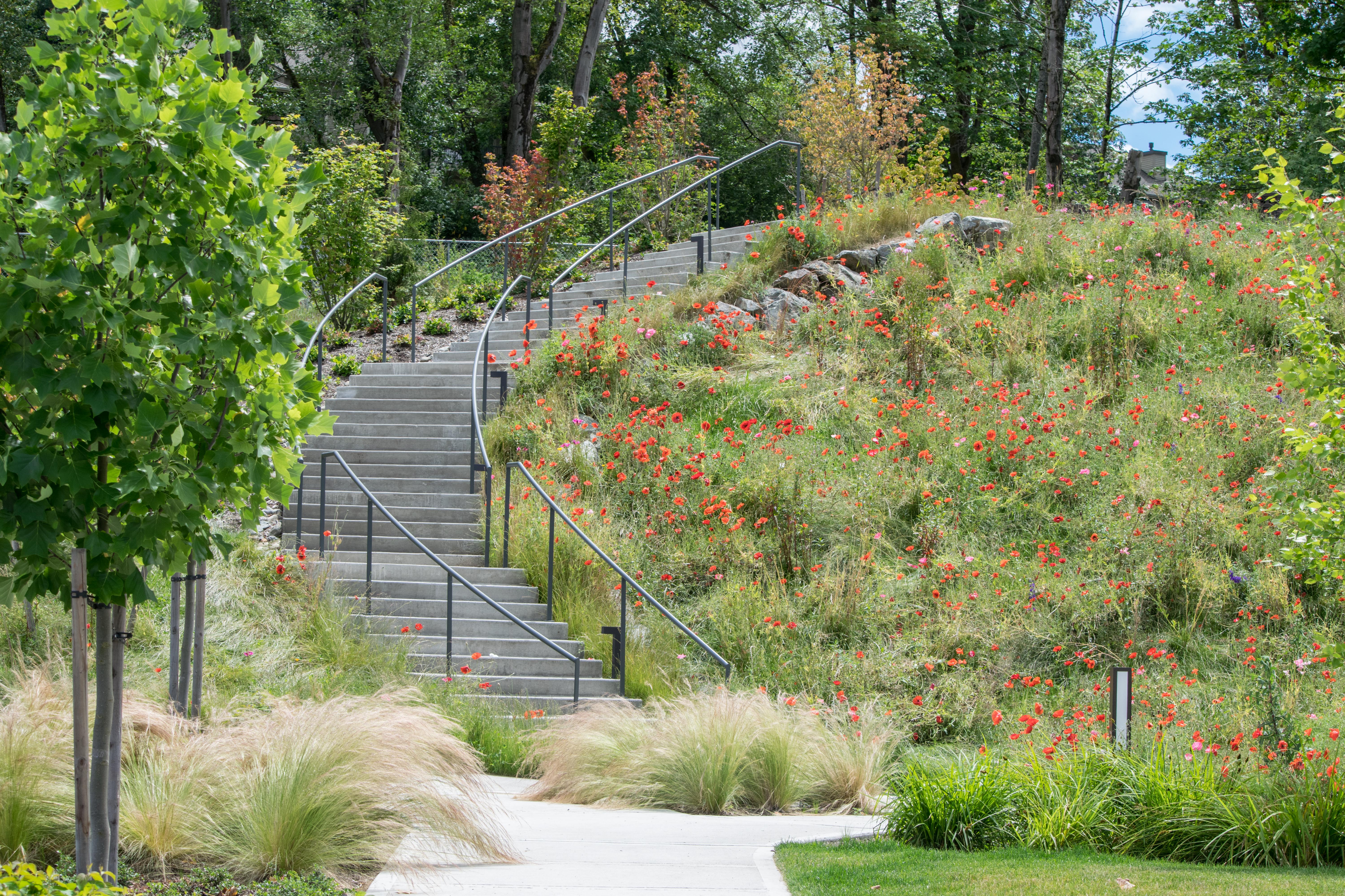
08 Trail Ascending Steps to Overlook
Overview
0.6 miles
4 Roads,
0 Driveways
![]()
![]()
From Coal Creek Trail thru Newcastle Commons to the Golf Course Trail
Description
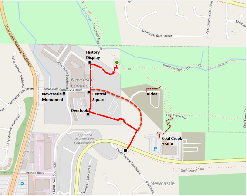
The Thomas Rouse Trail celebrates Newcastle's coal-mining history. It runs south from Bellevue's Coal Creek Trail through Newcastle Commons to the Golf Course Trail, crossing Newcastle Commons Drive at the Central Square. A block north of the Square, a history display area marks the access to the Coal Creek and Primrose trails. A block west is the Newcastle Monument (brick sculpture, history, restaurants). A block south, the trail climbs to an overlook and turns southeast, now a footpath. It descends to cross a street, ascends on steps, and rejoins NC Drive near the YMCA (and historic Thomas Rouse Road). For an easy shortcut (no steps), follow NC Drive east from the Square. For a map showing 1883 Newcastle and its railroad, see History.
See Extended Description and Future Plans below.
| Hide Trail Map | ||
|
||
1. The Thomas Rouse Trail starts on the Coal Creek Trail, which runs .7 miles north to Coal Creek Parkway (and beyond), and southeast 1.7 miles to the history-rich Red Town Trailhead in Cougar Mountain Park. A short walk southeast brings you to the Primrose Trail, which follows Coal Creek, crossing on footbridges, and rejoins the Coal Creek Trail after .7 scenic miles. The Primrose Loop uses both trails, returning .6 miles on the Coal Creek Trail past access trails from the Coal Creek YMCA (YMCA Trail) and Aldea (east Commons).
2. The trail ascends to Newcastle Commons on switchbacks and steps (steep, no railings). It jogs west to the north end of 134th Place SE, at a History Display with a trail map and photos from Newcastle's coal-mining era (1863-1963). From there it follows 134th on sidewalks 2 blocks south to the overlook, crossing Newcastle Commons Drive at the Central Square. Note the benches, with coal-car wheels. With parking and restaurants along NC Drive from Square to Parkway, the Commons makes a fine trailhead.
3. Detour west one block to the Newcastle Monument, built by modern Newcastle (incorporated in 1994) to celebrate old Newcastle. The artist used bricks from the Mutual Materials brickyard here, closed in 2011. Interpretive signs discuss the interplay of art and history.
4. Follow the trail south on sidewalks, or take NC Drive east for an easy shortcut to the final trail section (5). The southbound trail ascends on graceful stairs with railings to the Overlook, a mini-park with views. From here a crushed-rock footpath heads east to rejoin NC Drive near the YMCA. The first half of the footpath is lined with condos or apartments on the north, and construction sites on the south. On the second half you cross a street and ascend on steps with railings, woods on your right, dwellings on your left giving way to open space.
5. The final trail section runs south on sidewalks to nearby Newcastle Golf Club Road, passing west of the YMCA and crossing the road to the Golf Course Trail. This trail follows the road east from nearby 136th Ave SE (the historic Thomas Rouse Road) to Cougar Mountain Park at 155th Ave SE. If you cross 155th and follow the sidewalk about 500 feet uphill, you'll find a short unmarked trail running east to the Red Town Trailhead and the end of the Coal Creek Trail. You can take this trail back to the Commons, passing historic sites and waterfalls, perhaps taking the Primrose Trail along the creek until it rejoins the main trail.
History Note: From 1864-1963 this was a coal-mining district with two mining towns: Newcastle (just south of the present-day YMCA), and Coal Creek (at the Red Town Trailhead). 1883 Newcastle was served by a railroad, and linked to May Valley farms by the Thomas Rouse Road. For details (with map) see History; for more information (and photos) visit the Newcastle Historical Society.
Future Plans
The present Thomas Rouse Trail is the first segment of the 3-segment Thomas Rouse Trail proposed in Newcastle's 2019 Comprehensive Plan. Segments 2 and 3 continue south on the historic Thomas Rouse Road (now 136th Avenue SE) to the East CrossTown Trail at SE 79th Street. Here you can head east to Cougar Mountain, or west down 79th to Lake Boren and the West CrossTown Trail. Segment 3 is complete; segment 2 is not. But completion is set for 2024-2025, as part of a new development.
Segment 2 follows 136th Ave SE south from Newcastle Golf Club Road to China Falls Park. 136th is a quiet street, shaded by dense woods on both sides. A new development north of China Falls (the Baima House Project) will complete the trail by completing segment 2, using sidewalks and boardwalks designed to preserve existing trees. A history park in the northwest corner of the development will preserve the old Baima House. The Newcastle Historical Society is working to preserve other remnants of old Newcastle – including an abandoned mineshaft.
Segment 3 is complete on sidewalks from China Falls Park to the CrossTown Trail, with only two street-crossings. It follows 136th south past Redman Park (across the street) and the Thomas Rouse Road Historic Park. Then it curves west, crossing China Creek near a hidden waterfall, and terminating on SE 79th at Beit Tikvah Church.
The Thomas Rouse Trail could be extended to include the entire road. Segment 4 would continue south on 136th, and then on 144th to its end-point – the junction of the Terrace and Highlands trails. Segments 5 and 6 would follow the old road on trails and a short driveway (legal public access) to May Valley Road. For more on segments 1-6 see Thomas Rouse Road.