
Coal Creek Trail

00 Trail heading southeast from Red Cedar Trailhead
01 Trailhead on 119th Ave SE just south of Parkway

02 Red Cedar Trailhead on Coal Creek Parkway
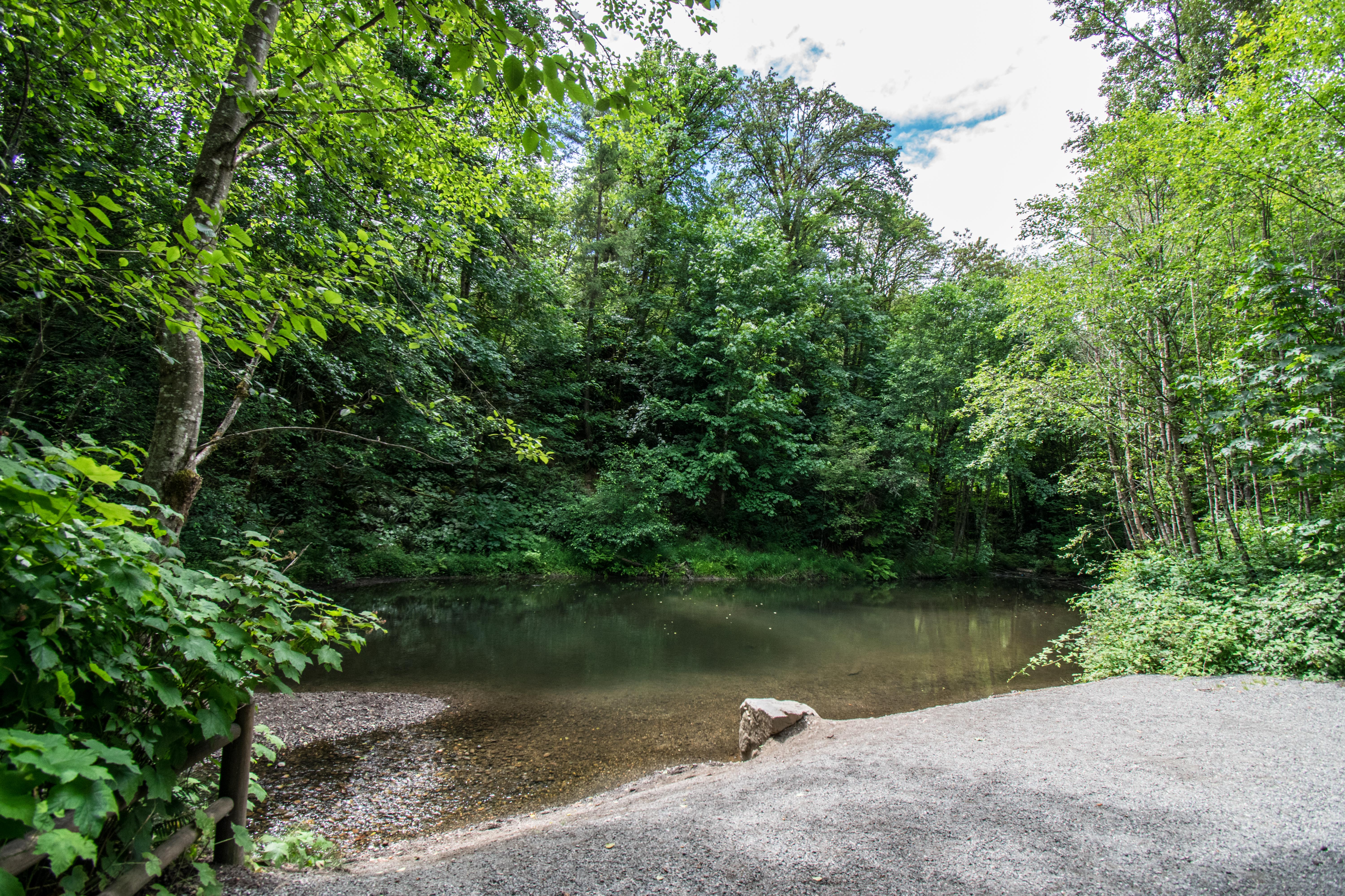
03 Coal Creek at pond near Red Cedar Trailhead
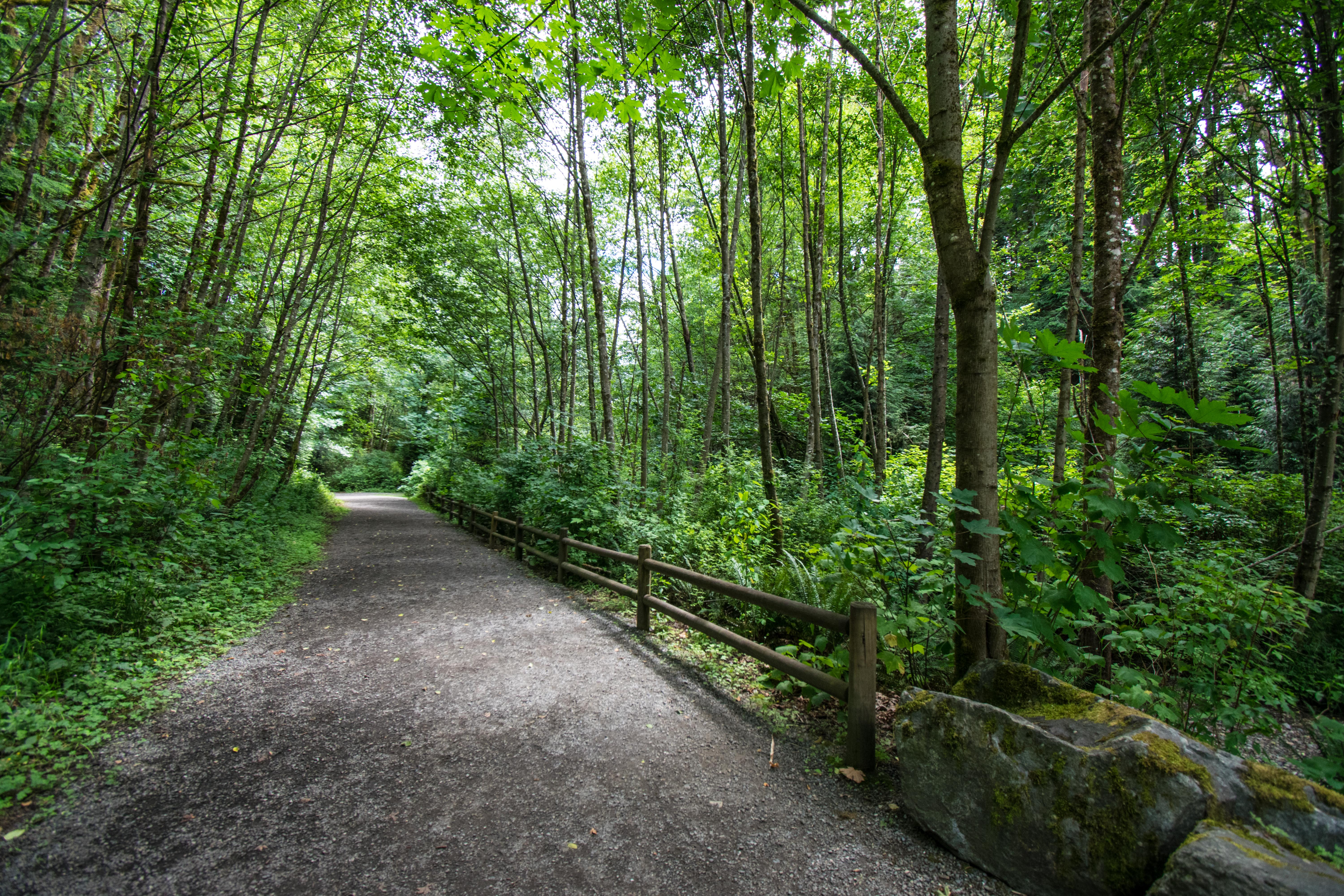
04 Trail heading southeast from Red Cedar Trailhead
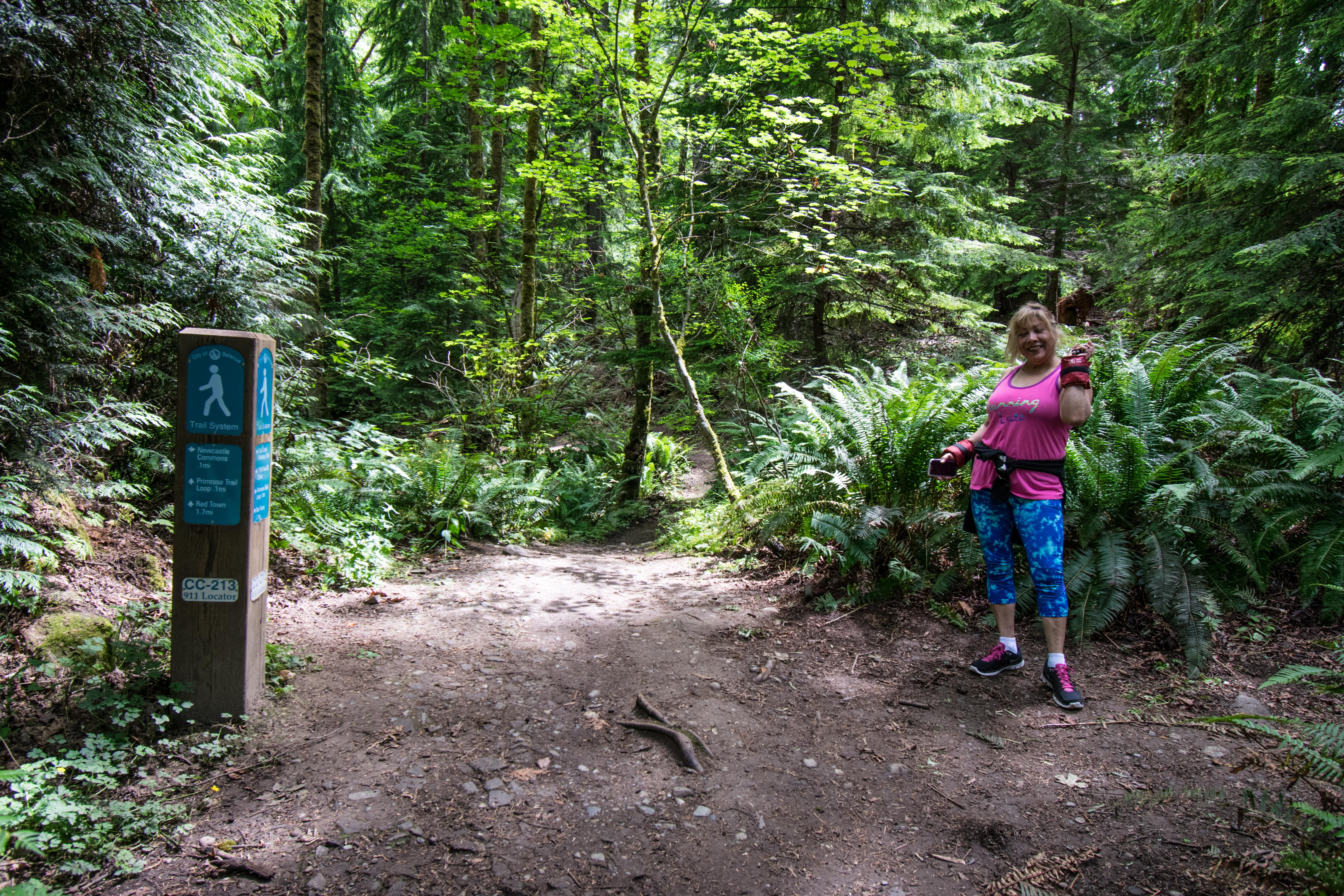
05 Junction with Thomas Rouse Trail to Newcastle Commons on right
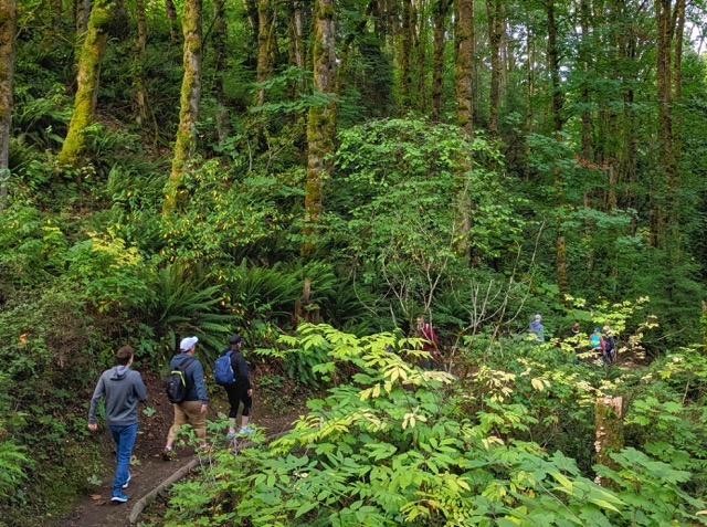
06 Walkers headed west near Newcastle Commons

07 Primrose Falls near Red Town
Overview
4.4 miles
0 Roads,
0 Driveways
![]()
![]()
From 119th Ave SE at Parkway along Coal Creek to Cougar Mountain Park
Description
Bellevue's Coal Creek Trail runs southeast from 119th Ave SE (near Coal Creek Parkway at I-405 exit 10) to the Red Town trailhead in Cougar Mountain Park. The trail follows the creek's heavily wooded valley, crossing footbridges and small ridges. It ascends the south slope, descends to Coal Creek Parkway, and follows the creek under the Parkway to the Red Cedar Trailhead (parking, bench, map kiosk). It continues past access trails (from Forest Drive, Newcastle Commons, YMCA) to an old railroad grade, then past waterfalls, abandoned coal mines, and historic sites to Red Town in Cougar Mountain Regional Wildland Park.
See Extended Description below.| Hide Trail Map | ||

|
||
• Bellevue's Coal Creek Trail begins on 119th Ave SE just south of Coal Creek Parkway and exit 10 of I-405. The 240 bus stops here, but there's no parking. Instead, you can use Newcastle Beach Park as a de facto trailhead (parking, restrooms, woods, lovely beach). Follow the asphalt trail up the entrance road to the trail crossing where the brand-new Eastrail (Eastside Rail Trail) arrives from its south terminus at Renton's Gene Coulon Memorial Beach Park. The unfinished Eastrail section to the north will eventually run to and beyond Kirkland.
• At the trail crossing, turn left and follow the Lake Washington Bike Trail .5 miles north to 118th Ave SE (Lake Washington Blvd SE). Here a short trail branches right, passing under I-405 to 119th. The bike trail continues north, providing access to the Coal Creek Trail from Newport Shores and the I-90 Trail. Together, the I-90 and Coal Creek trails help complete a major trail segment in the Mountains-to-Sound Greenway.
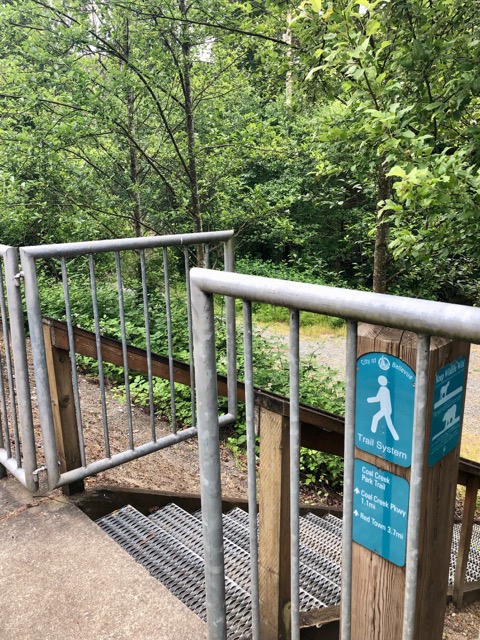
• Follow the branch trail under I-405, past the 114 bus stop. Cross the off-ramp, and follow the Parkway a few steps east to 119th, where a trail sign points to the "Coal Creek Park Trail". The sign may have been correct when it was new, but the trail is now the Coal Creek Trail. And the forested parkland it traverses is now Bellevue's Coal Creek Natural Area.
• The Trailhead on 119th Ave SE is a short distance south of the Parkway, just past the bus stop (bus 240). Here a trail sign (see photo 01 by Jan Miksovsky) gives the distance to Red Town as 3.7 miles. The correct distance is 4.2 miles.
• Descend on steps to the confluence of Coal Creek and Newport Hills Creek (flowing north from Newport Hills), and bear right. The Coal Creek Trail crosses the smaller creek on a bridge, and ascends on steps (with landings and handrails) to the ridge that separates the creeks. It levels out in a leafy tunnel of trees and ferns, with views right and left into both wooded valleys.
• The 121st Ave SE Access provides access from the north tip of Newport Hills via a short (.1 mile) access trail that joins the Coal Creek Trail about .2 miles from 119th. From here the trail continues another .9 miles to Coal Creek Parkway, descending to cross another tributary on a fine new bridge, ascending on switchbacks, crossing another ridge, and beginning a slow descent to the creek.
• The SE 60th Street Access is just east of 129th Ave SE and the Newport Hills Mini Park, which adjoins the northern extension of Newcastle's Waterline Trail. There's a small parking lot and a trail sign. The access trail descends .7 miles through shady woods to the Coal Creek Trail, which descends to the creek and continues east under the Parkway.
• The Red Cedar Trailhead is on the east side of the Parkway, with ample parking, a bench, and a kiosk with a map. The trail passes through the parking lot and continues in dense shady woods past a pond formed by Coal Creek. Walk to the bank and enjoy the views. A short distance in you'll pass a short access trail to Forest Drive; later you'll pass a longer access trail that ascends north to Forest Drive and well beyond.
• The Newcastle Commons is an access point with parking, restaurants, and outdoor art. Follow the main trail over some steep sections to a trail sign marking the start of the Thomas Rouse Trail, which branches right to the Commons. It ascends .2 miles to a trailhead kiosk, steep for 470 feet (switchbacks and steps), then flat. The kiosk, at the north end of 134th Place SE, includes a large trail map and historical information with photos. Follow the trail signs to a brick sculpture and historic site, the Newcastle Monument.
• A bit further on, the Primrose Trail branches left, descends to Coal Creek, and crosses it on sturdy bridges. After the final crossing it ascends and rejoins the Coal Creek Trail, forming a loop with the main trail.
• The Coal Creek YMCA is a short distance southeast of the Commons, with an access trail (.1 miles) marked by signs at both ends. Branching right from the main trail, the YMCA Trail dips into a small valley and ascends on switchbacks to the Y parking lot. The main trail continues east on an old railroad grade. After a mile or so, it descends to Coal Creek and a historic coal-mining area with waterfalls.
• The Cinder Mine Trailhead (parking, trail sign) is the trailhead for a .2 mile access trail that provides a direct route into the historic area with waterfalls.
• As the trail nears Coal Creek, it passes various historic sites (see History below). There's the site of a turntable for steam engines, and the foundations of coal bunkers. You'll see waterfalls in Coal Creek, and Primrose Falls (also called North Fork Falls) plunging from a cliff. Interpretive signs describe the history of the area.
• The trail ends at the curve where Newcastle Golf Club Road becomes Lakemont Boulevard. Cross the road to the Red Town Trailhead (parking, map kiosk) in the Red Town area of Old Newcastle. Explore the many trails of Cougar Mountain Regional Wildland Park or return to the YMCA on the Golf Course Trail.
History
The Coal Creek Trail from the YMCA to Red Town is rich in history. A hundred years ago Red Town was the center of a large coal-mining area, and the trail was the roadbed of the Seattle & Walla Walla Railroad. Red Town was part of an earlier Newcastle, a company town centered on the mines. At one time, Newcastle was bigger than Seattle. It had homes for miners, a company store, a hotel, a power plant, and many other buildings. Coal moved from the mines into huge buildings for processing; then it was loaded onto trains, carried to Seattle, and shipped to West Coast cities. Coal mining here spanned 100 years, from 1862 to 1962, leaving the area honeycombed with tunnels. The tunnels are now closed off, but there's plenty to see along the trail.
Seattle & Walla Walla Railroad: This railroad (initially narrow gauge), ran from Seattle around the south end of Lake Washington to the mining area at Red Town. It crossed May Creek on a wooden trestle, and followed May Creek northeast towards Lake Boren; a long stretch of the railroad grade is now used by Newcastle's May Creek Trail. Over the years the railroad bed was built up from cinders, which sometimes caught fire.
Turntable: On the right as you approach Red Town, there's a circular depression with a cement foundation in the center. Here was an Armstrong turntable, where men with strong arms turned steam engines for the return trip to Seattle.
Falls & Flume: Just after the fenced area, move close to the creek and note the small waterfall and the wooden floor of the flume just above it. Above this area, the creek was carried in a wooden flume.
Coal Bunkers: Cement foundations on the hill to the right supported bunkers for coal. The coal was carried in rail cars from the mines. It flowed down through large structures, where it was washed and sifted. Then it was stored in bunkers, and eventually dumped into coal trains.
Primrose Falls: On the left, further on, a waterfall plunges into the creek. Years ago the water gushed from a hole in the cliff, the end of a tunnel that drained the Primrose Mine. After a heavy rain, the falls ran red from minerals in the mine. The sandstone cliff is still stained by iron and sulfur compounds, but the tunnel has collapsed, and a stream (the North Fork) flows in the resulting depression.
History and Geology: The Primrose Mine is the youngest mine, on a seam of coal laid down 35 million years ago. The 12 seams, or layers of coal, were laid down at intervals from 55 to 35 million years ago, alternating with sandstone and shale. The seams were pushed to the surface 30 million years ago as part of an east-west ridge; the north-south Cascades arose 15 million years ago; and the Olympic Mountains a mere 5 million years ago. In the last 210,000 years, mile-high glaciers have filled Puget Sound 7 times, arriving every 30,000 years and reshaping the landscape. In and around Cougar Mountain Park you can find glacial erratics, boulders carried from far away and dropped when the glacier melted.
Petrified Wood: You can still find chunks of coal and petrified wood. Coal is formed when organic material, including wood, is compressed. If minerals replace the wood first, you get petrified wood instead of coal.
Footbridge: Where the footbridge crosses the stream, you can see part of the flume, and a railroad milepost (moved a few feet). We're 20 miles from Seattle by the old railroad.
Power House: The power house generated electricity for the mines and homes. The building straddled the creek; you can see foundations for heavy machinery.
Air Shaft: On the left behind a fence is an air shaft to the #4 coal seam.
Company Store: As the trail ascends through a switchback, we enter the back of the company store. In this back storeroom, the floor descended on a tram to the railway and brought goods up to the store.
Hotel: A concrete foundation north of the store once supported the hotel's boiler.
Sinkholes: As you follow the trail to the road, you can see depressions where the ground is subsiding into the #3 seam. Sinkholes elsewhere have grown large enough to swallow houses. Sinkholes can be dangerous; people and animals can fall in, and the tunnels may contain water or deadly gases like methane, carbon monoxide, and carbon dioxide.
Red Town: Across the road is the Red Town Trailhead in Cougar Mountain Park; from here you can take trails all over the park. The second Newcastle was centered on the mines and railroad, but it had several housing areas: Red Town (houses painted red); White Town (white houses); Finn Town (Finnish miners); and Rainbow Town (where houses were not owned by the company, and colors varied). Most of the houses were moved elsewhere when the mines shut down.
Swanson House: Northwest from Red Town is one of the original houses, now occupied by Milt Swanson, who was born in 1909, lived in old Newcastle, and rode the old steam trains. He has a museum which he opens for visitors.