
Primrose Trail
00 Bridge across Coal Creek
01 Trailhead on Coal Creek near Newcastle Commons
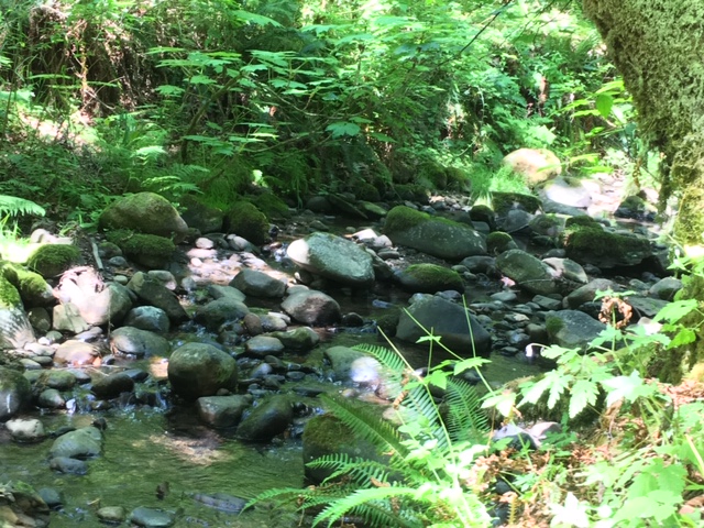
02 Creek in summer
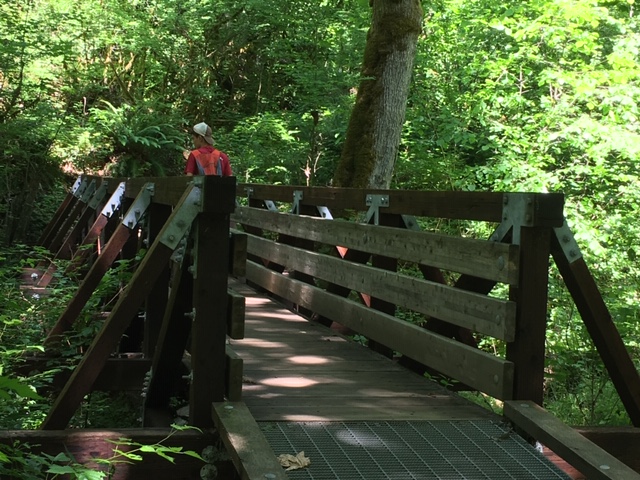
03 First footbridge
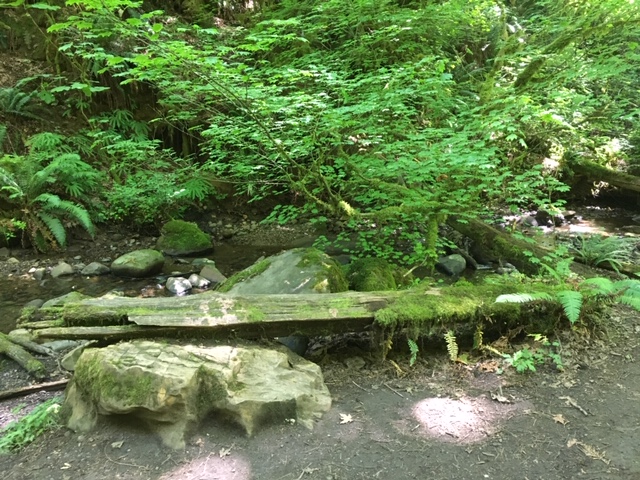
04 Glade by creek with mossy log
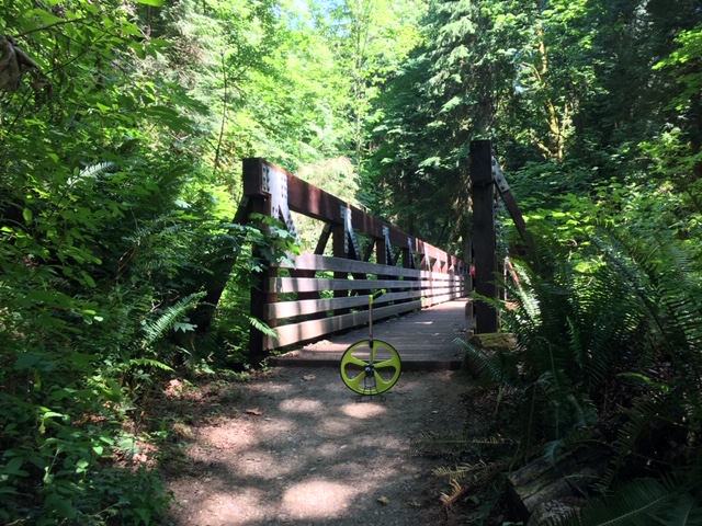
05 Bridge with trail wheel
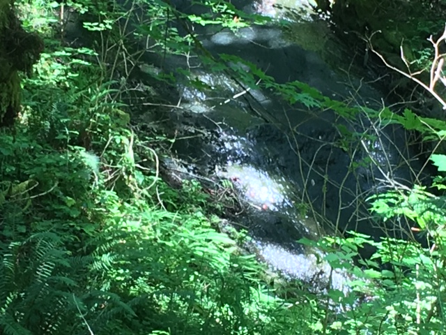
06 Sandstone Falls
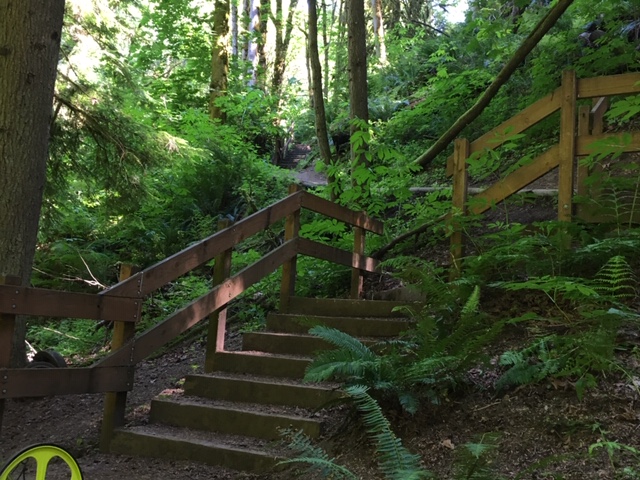
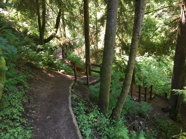
07 Ascent from Coal Creek
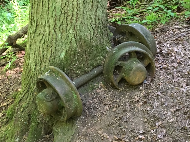
08 Wheels of coal car from mining era
09 Looking back towards Coal Creek
10 End of Primrose Trail on Coal Creek Trail east of YMCA
Overview
0.7 miles
0 Roads,
0 Driveways
![]()
![]()
Branches from Coal Creek Trail east of Parkway, follows creek, rejoins trail
Description
In conjunction with the Coal Creek Trail, this trail provides a pleasant scenic loop walk that crosses Coal Creek on attractive bridges. It starts on the Coal Creek Trail near Newcastle Commons, one mile southeast from the Red Cedar Trailhead on Coal Creek Parkway. The trail meanders near Coal Creek in a deep valley with dense woods, ferns, and moss. When it rejoins the Coal Creek Trail, you can continue one mile east to Red Town and Cougar Mountain Park, or loop .6 miles back to the trailhead, passing a short access trail to the YMCA. The trailhead is only .3 miles by trail from the Commons. See Extended Description below.
| Hide Trail Map | ||
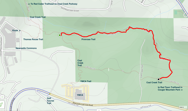
|
||
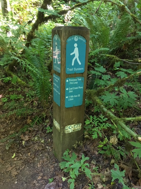
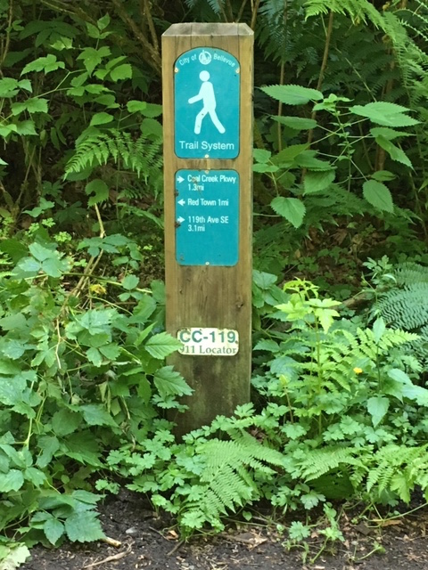
• Bellevue's Primrose Trail starts on the Coal Creek Trail where it passes Newcastle Commons, .8 mile southeast from the Red Cedar Trailhead on Coal Creek Parkway. From Newcastle Commons Drive, take 134th Place SE north to the trail kiosk, and follow the trail heading east. The trail is flat for about 360 feet; then it descends on steps into the woods, joining the Coal Creek Trail .15 miles from the kiosk. Turn right and follow the trail across a narrow bridge. At the next trail sign, just .3 miles from the kiosk, turn left onto the Primrose Trail.
• From the trailhead sign, the Primrose Trail meanders east along the south side of Coal Creek. About 650 feet along, the trail dips down to the creek; further on, it crosses a sturdy wooden bridge to the north bank, and continues east under mossy trees.
• About .26 miles from the trailhead, you'll encounter a pleasant glade, a clearing along the creek with a fallen log for a bench. Pause and enjoy the sights and sounds of nature.
• The trail continues across two more bridges, small and large, to Sandstone Falls. Here sheets of water slide down a steeply sloped wall of blackened rock into a dark pool.
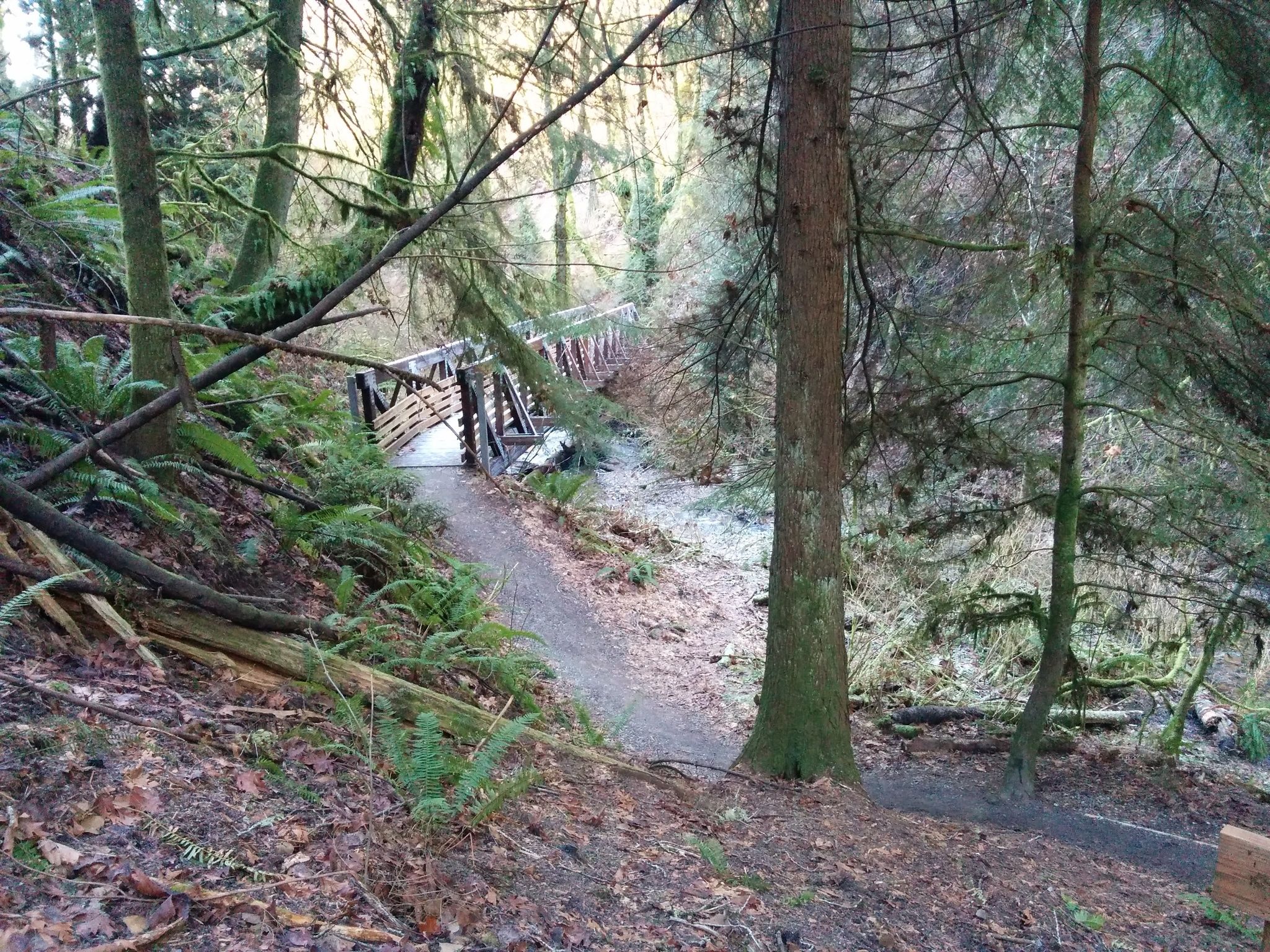
• The final bridge is .34 miles from the trailhead, the longest and largest so far, a 120-foot pony truss bridge with good views of the creek. After crossing the bridge, the trail ascends on steps with railings. Look to your left and notice the iron wheels, remnants of a coal car from a nearby mine. Now the trail runs level for a stretch, Coal Creek descending in the valley on your left.
• The trail rejoins the creek one last time .47 miles from the trailhead. Here there's another wooded glade, a pleasant spot where you can get down close to the water.
• The trail ascends from the creek onto a broad plateau where the historic Seattle and Walla Railroad once carried coal from the mines. Look around for bits of coal, and a cable half-buried in the trail. Look down to your right into the green bog .55 miles from the trailhead.
• After .74 miles the trail ends at its second junction with the Coal Creek Trail. From here you can turn right and walk .58 miles back to the trailhead, passing the YMCA Trail and completing the Primrose Loop. Or, you can turn left and follow the Coal Creek Trail east one mile to the Red Town Trailhead for Cougar Mountain Park, following the old railroad right of way to the historic mining area. From Red Town you can make a return loop to Newcastle Commons: follow the Golf Course Trail west; at the trail sign just past the YMCA, follow the Thomas Rouse Trail across the road and back to the trail kiosk.