
Mid May Creek Trail
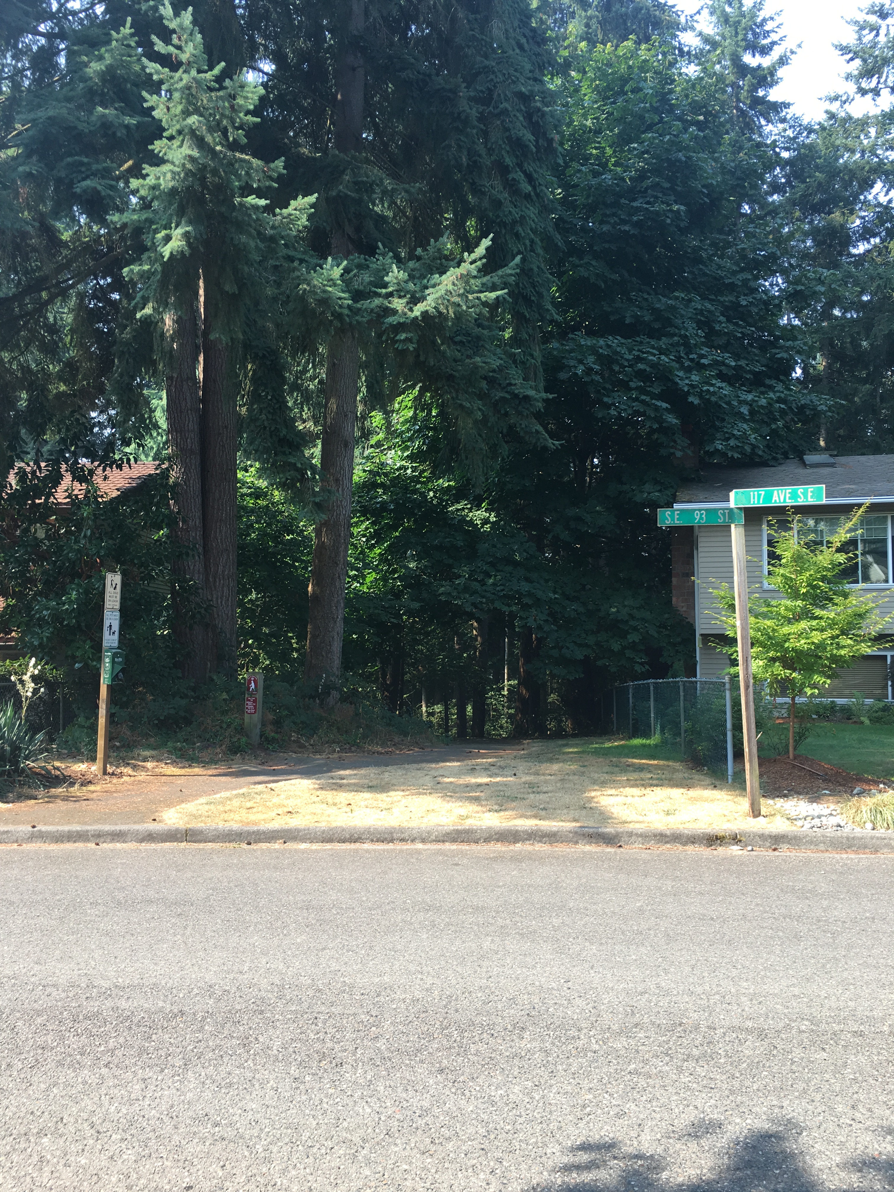
01 Trailhead in Windtree Neighborhood at Windtree Steps

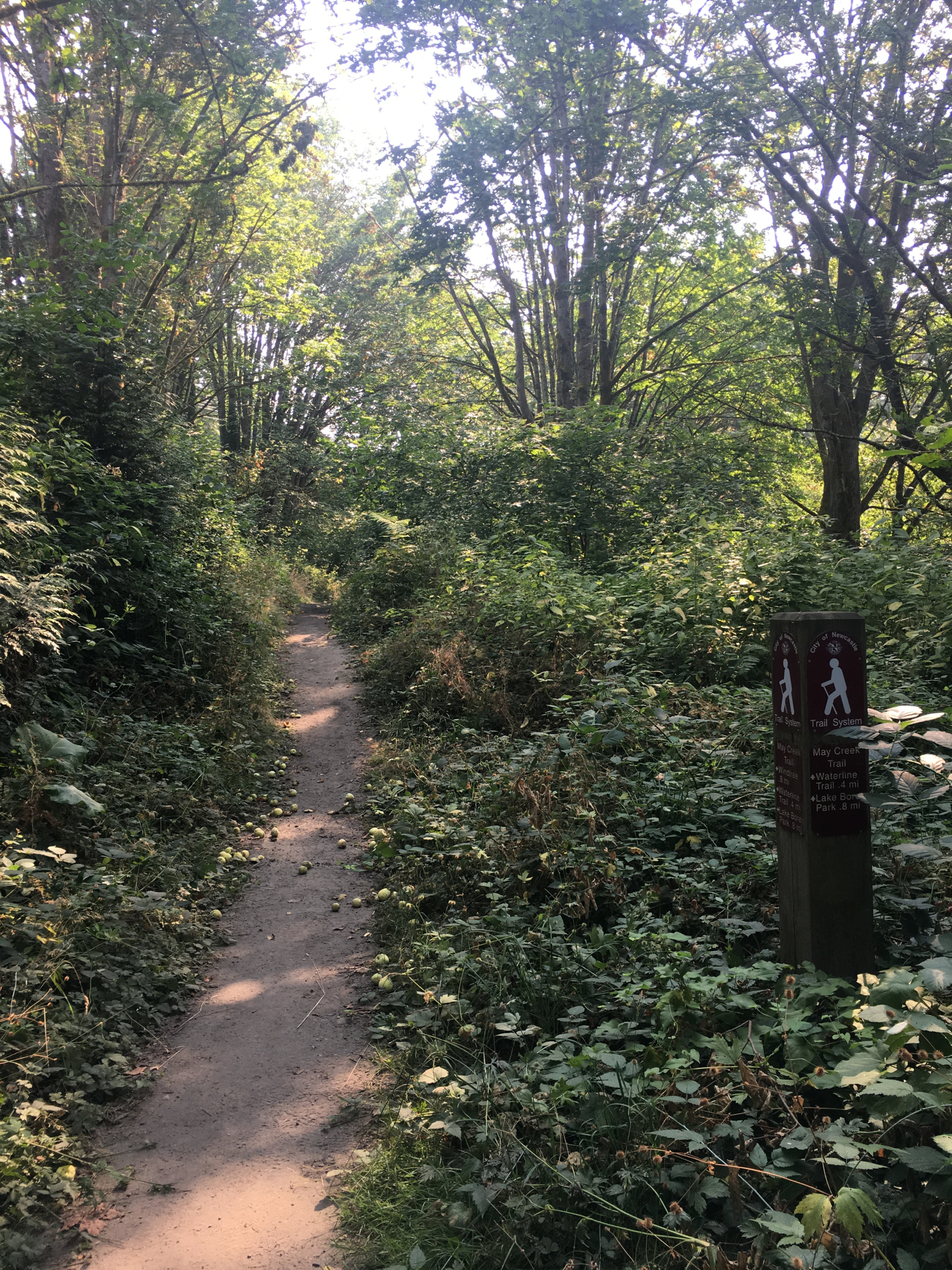
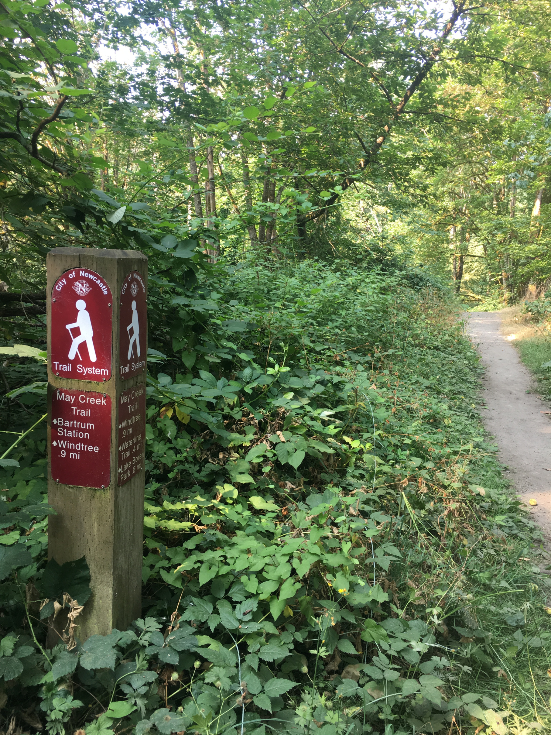
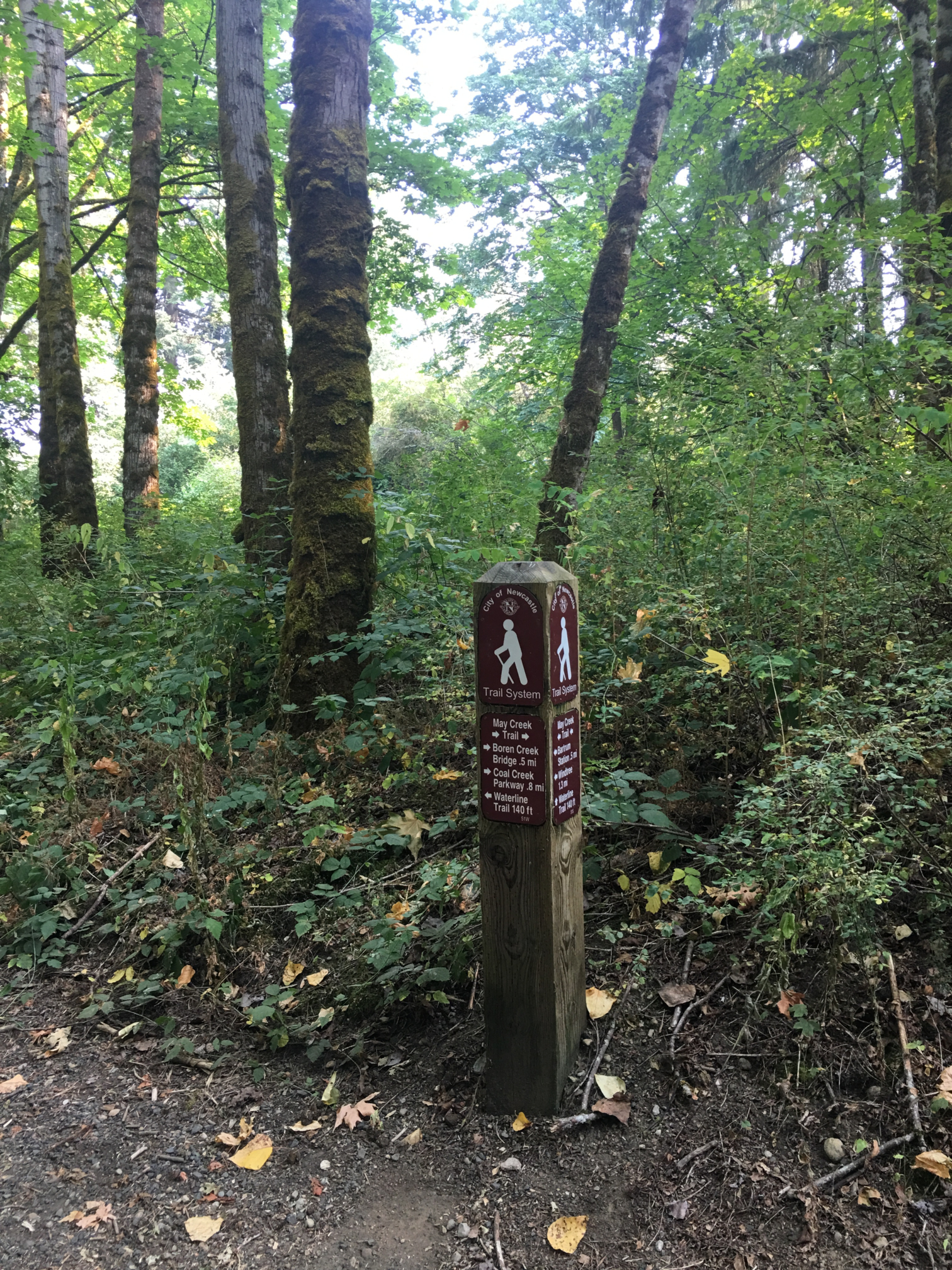
02 Trail Sign

03 Trailhead Bench

04 Top of Windtree Steps

05 Windtree Steps

06 Looking Back

07 Trail above Gypsy Creek

08 Site of Historic RR Trestle

09 History Kiosk with Photos

10 Trestle Site Overlook

11 Trail on Railroad Grade

12 Footbridge on RR Route

13 Entering Bartrum Station Area
14 East of Bartrum Station
15 Looking Back
16 Access left to Waterline Trail, right to East May Creek Trail
17 End of Mid May Creek Trail at junction with Waterline Trail
Overview
1.3 miles
0 Roads,
2 Driveways
![]()
![]()
![]()
A rail trail from Windtree in SW Newcastle east to the Waterline Trail
Description
The Mid May Creek Trail starts in the southwest corner of Newcastle and runs generally east through May Creek Park to the Waterline Trail, following May Creek but staying well above it. From the Windtree neighborhood, 40+ steps descend to an easy trail in a wooded valley. Above May Creek, a kiosk with maps and photos marks a historic site where the Seattle and Walla Walla Railroad crossed May Creek on a high trestle. Beyond the kiosk, the trail is mostly wide and flat, following the old rail route on broad curves. The creek is invisible in summer, but railroad cuts and fills add interest to a pleasant woodland walk. The NT trail map shows the trail extending down to May Creek, which it does. The map below shows the current walking route, which starts above the Windtree Steps and descends past the history kiosk to the main trail on the old rail route. See Extended Description and Future Plans below.
| Hide Trail Map | ||
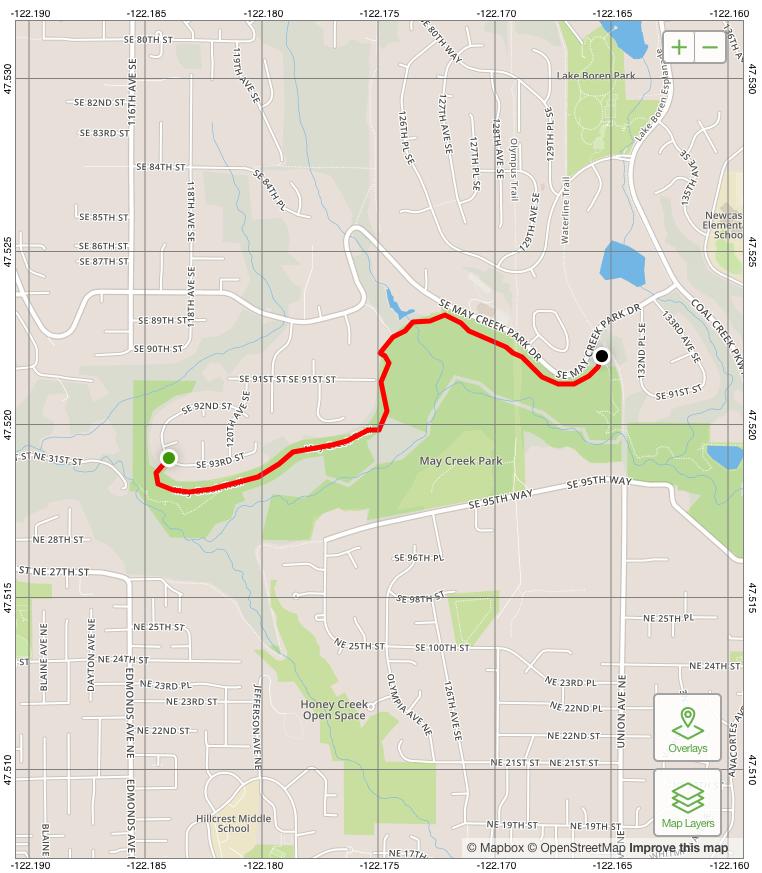
|
||
1. The current trailhead is at the Windtree Steps, near the junction of 117th Ave SE and SE 93rd Street. The trail starts in a flat area with a trail sign, a bench, and greenery. It descends steeply on 40+ steps into the valley of May Creek, turns left, and follows the contours in an easy descent, heading east past a history kiosk.
| The kiosk is an attractive cedar-roofed structure built by the local Scout troop in cooperation with the Newcastle Historical Society and Newcastle Trails. It marks the northeast end of a long-gone railroad trestle that carried the historic Seattle and Walla Walla Railroad across the valley. The display includes a large trail map, photos of the old trestle, and other documents and photos. There's a nearby viewpoint and bench. |
2. The trail continues past the kiosk on the roadbed of the old railroad. At bit farther on, a forest trail branches right, angling down and west toward May Creek.
| This forest trail has nice views of May Creek as it gently descends by Picnic Bluff (with a picnic table) to May Creek. When Renton's West May Creek Trail is completed years hence, and a long-proposed footbridge spans the creek, this bridge will mark the start of the Mid May Creek Trail. During the summer especially, kids and dogs enjoy investigating the gravel and sand banks of the creek. During the winter, it’s more like a rushing river that often reaches the vegetation line at the tops of the banks. It’s enjoyable to see the changes from day to day. If you’re lucky, you can see a peamouth minnow or its redd (watery nest of yellow eggs about 6 inches thick) during the 3 days or so the foot-long minnows are spawning. After 3 days, the eggs hatch and the fry swim down to Lake Washington to mature. Salmon aren’t as plentiful as they were, but they still migrate up May Creek in the fall. River otters sometimes come to feed, especially on the peamouth minnows. |
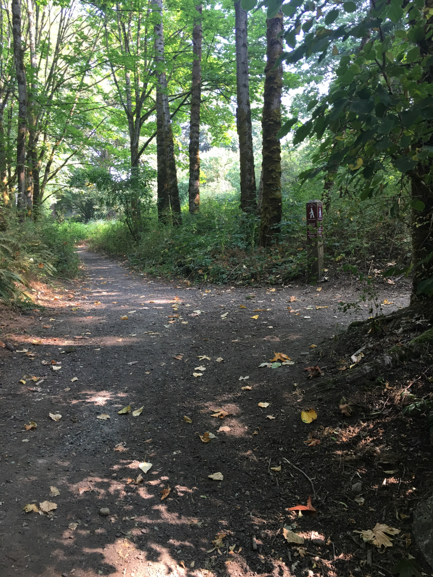
3. From here the trail continues eastward, generally following the broad, flat roadbed of the old railroad through cuts and over fills, mostly in woods, parallel to (and well above) May Creek. Periodically, it detours by large trees and old landslides. At a small footbridge, the trail bypasses the often wet railroad bed, meanders under old fruit trees, and rises up to the rim of the railroad cut.
4. Enter a driveway between boulders and go right into the area of Bartrum Station.
| Bartrum Station was a railroad siding named after a local farmer, where the railroad picked up farm goods for the miners of old Newcastle. Now it's a clearing in a utility corridor, where 124th Ave SE provides trail access from SE May Creek Park Drive. Here the trail follows a sometimes muddy park road used by adjacent homeowners. |
5. From here to the Waterline Trail, the May Creek Trail runs parallel to SE May Creek Park Drive; it's wider, more open, and generally more level. The trail passes through a final railroad cut and ends in the woods just west of the waterline corridor. A trail sign here marks the end of the Mid May Creek Trail and the Waterline Trail, and the start of the East May Creek Trail.
| At this trail junction, you can follow the Waterline Trail north to Lake Boren Park, or continue east on the East May Creek Trail, which descends to the creek, follows it a short distance, and ascends to Coal Creek Parkway. You can also access the May Creek Trail from Lake Boren Park, using either the Waterline Trail, the Parkway sidewalk, or the Milepost Trail (or using two of these trails in a loop). |
Future Plans
Two Renton projects will impact the Mid May Creek Trail when completed: the West May Creek Trail, and Kenyon Dobson Park.
The West May Creek Trail can be completed by: (a) extending it under I-405; (b) building a trail from I-405 to the Newcastle boundary, and (c) building a footbridge across May Creek into Newcastle. (a) depends on the I-405 interchange project, scheduled for completion in 2024. (b) can be done in stages, with tree-shaded, low-traffic "Jones Road" (Jones Ave NE and NE 31st Street) providing a temporary trail route along May Creek. (c) requires a long footbridge; hopefully Renton, Newcastle, and King County will combine to pursue grants.
Kenyon-Dobson Park will make a fine trailhead for the proposed Gypsy Creek Trail connection to the May Creek Trail. The unfinished Renton park is located just southwest of the junction of 116th Ave SE and May Creek Park Drive in SW Newcastle. The proposed Gypsy Creek Trail (see Trail Planner) and continue on the existing trail below the Windtree Steps to join the Mid May Creek Trail just past the history kiosk. It should be easy to complete the trail (a great Scout project) and provide walking routes to the park from Newcastle.
The synergy between these projects strengthens the argument for the footbridge. It will provide an east-west link that completes the May Creek Trail, and the May Creek Greenway from Lake Washington to Cougar Mountain. It will provide a north-south link from Kenyon Dobson Park across May Creek to Kennydale and the Renton HIghlands (via the Honey Creek Trail). And completing the Greenway will open up regional hiking routes, including the Grand Loop around Newcastle, and the Grand Traverse to Issaquah (see Newcastle-Cougar Map).