
Welcome to Newcastle Trails
Dedicated to preserving, expanding, and maintaining the trails within the City of Newcastle, Washington.
NEWCASTLE TRAILS is a 501(c)3 not-for-profit volunteer organization focused on the preservation, expansion, and maintenance of trails within the City of Newcastle, Washington.
We recommend trail routes, identify priorities, and maintain a registry of volunteers to assist the City in trail work. Trail efforts will be planned and budgeted by the City in conformance with the Parks and Trails Plan.
We also maintain a list of Trails, a Trail Map, and a Trail Guide. And we offer a Trail Book and a Newcastle-Cougar Map showing regional trails and projects. To locate a trail, use the Trail Finder or Trail Plan. Volunteers are encouraged to help with work parties and trail walks. The Board of Directors meets monthly. Board Meetings, trail walks, work parties, and other scheduled events can be found on our Calendar. News appears on this website and in our emailed newsletter.
Members need not reside in Newcastle. There are no dues. Contact us for more information.
When You Walk Our Trails
Consider carrying a litter bag or clippers, picking up litter or trimming intrusive plants as you go. Many trail users do this from time to time, and it's a great help. Aside from that, Leave No Trace. For major problems - a fallen tree or a washout - call the City of Newcastle at 425-649-4444. Better yet, file a written report with the City using the online application SeeClickFix as described below.
Report Non-Emergency Trail Issues Using SeeClickFix
Trail or non-trail maintenance issues ranging from downed trees to vandalism can be reported to the City using the application SeeClickFix from your desktop or laptop computer. You can also install the SeeClickFix app on your Apple or Android devices to report from the trail (and include a photo of the problem). To report any issue or download the app, go to REPORT AN ISSUE on the Newcastle website. SeeClickFix will use the location of your device, or a location you enter on your computer, to put a point on a map showing the location of your issue and nearby issues.
|
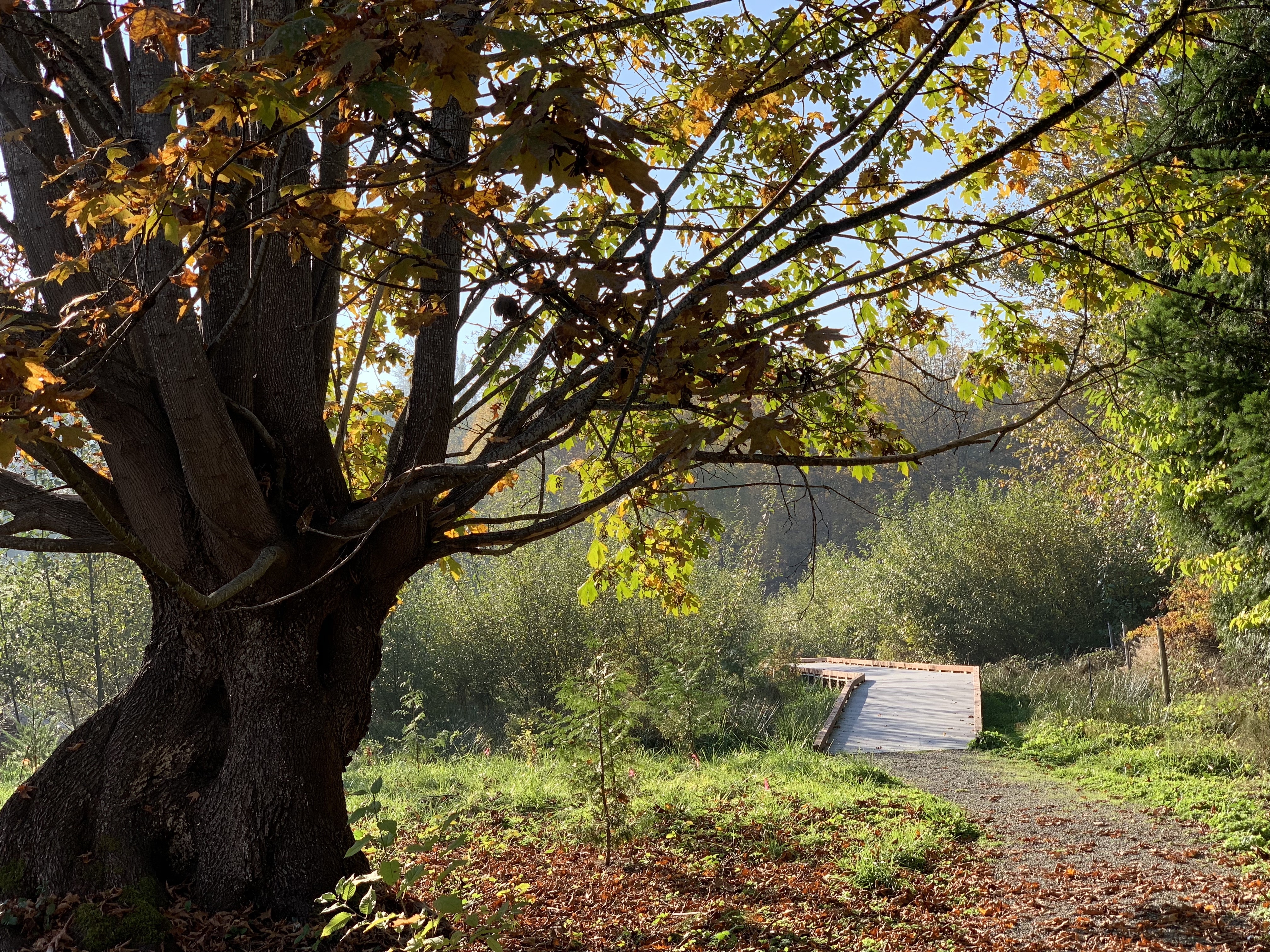
| China Creek Boardwalk (winner of 2018 photo contest) |
Affiliate Links
- Facebook Home of Newcastle Trails
- Instagram Home of Newcastle Trails
- City of Newcastle Parks and Trails
- Cougar Mountain Trail Map
- Issaquah Alps Trails Club
- Interlaken Trailblazers Volkssport Club
- Bellevue Nature Trails
- King County Regional Trails
- Washington Trails Association
- Mountains to Sound Greenway